Yosemite 8-12 September 2007 |
Saturday, 8 September
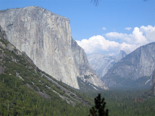
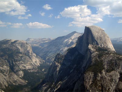
Our first glimpse of Yosemite Valley was a welcome sight after a very long drive from Irvine.
Massive El Capitan looms on the left and Half Dome can be seen peeking out just to the right of center.
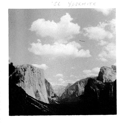
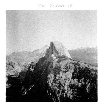
Here's how the same scene looked to Hank when he and his parents arrived in Yosemite almost 51 years ago! On 10 September 1956, Hank wrote in his diary: We got to Yosemite about 11:00. We rented a cabin and started sightseeing. I took some pictures. We visited the museum. The program in the evening on the patio included a folk singer and some slides. |
 |
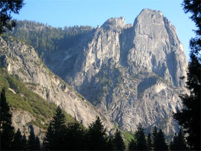
After checking into Yosemite Lodge, we took a stroll along the nearby bike path.
The late afternoon sun was still shining on the towering cliffs on the Valley's south side.
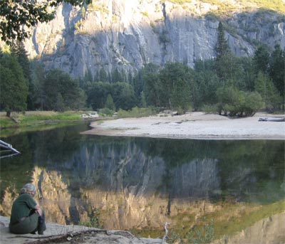
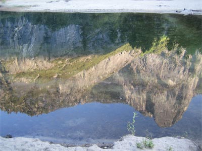
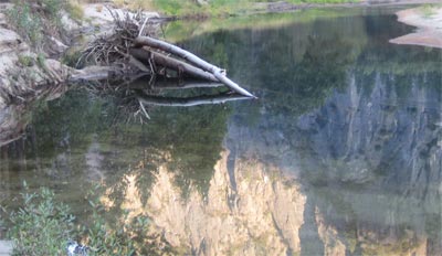
We could view their reflection on the calm surface of the Merced River...
and watch the lazy logs rest along the river bank.
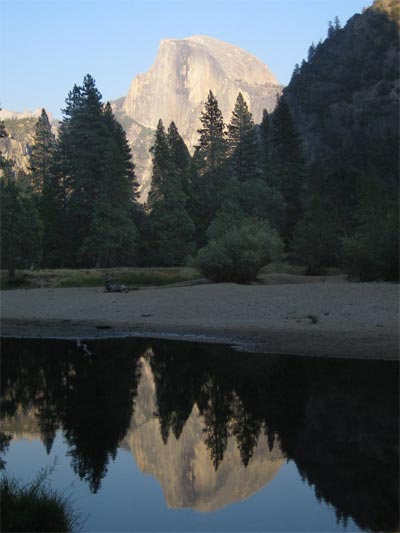
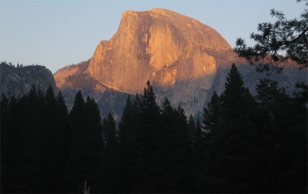
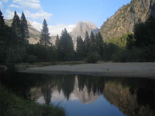
A small turn in the river gave us a surprise -- a great view of Half Dome and its mirror image...
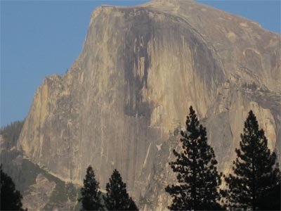
Here's a closeup of Half-Dome's illuminated face...
and another shot of its spectacular appearance a little later in the orange sunset light!
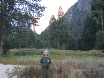
Before heading off to dinner, we explored one of the many colorful valley meadows.
![]()
![]()
![]()
Sunday, 9 September
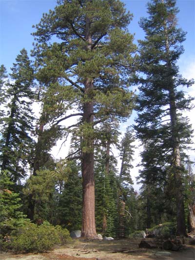
After breakfast, we headed off to the Tioga Road.
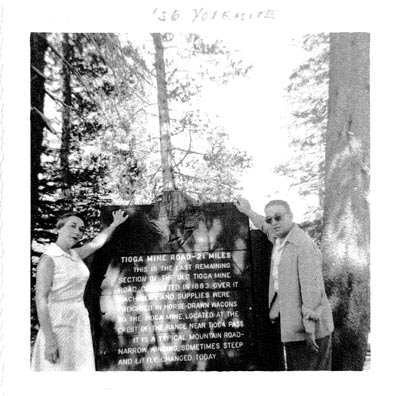 |
Hank took this photo of his parents when, as he wrote in his diary on 11 September 1956: "We took a ride on the old Tioga Road built in the late 19th century. For 21 miles it was a one lane curvey road." The inscription on the plaque reads: TIOGA MINE ROAD -- 21 MILES This is the last remaining section of the old Tioga Mine Road, completed in 1883. Over it machinery and supplies were freighted in horse-drawn wagons to the Tioga Mine, located at the crest of the range near Tioga Pass. It is a typical mountain road -- narrow, winding, sometimes steep and little changed today. |
The Tioga Road (fortunately) is greatly changed from what it was in 1956, but still steep and "curvey". For any Prius owners reading this, getting above 9,000 ft elevation caused us some concern when our battery indicator dropped to near zero. It turns out that this is a common occurrence at high elevations and not the imminent disaster we imagined at the time. Many thanks to the "good Samaritan" at the Tuolomne Meadows gas station who encouraged us to stop worrying! Happily, we filled our tank there. Thanks to gravity and the Prius's engineering, we didn't have to fill up again until after we returned to Irvine, having averaged 57.5 mpg!!
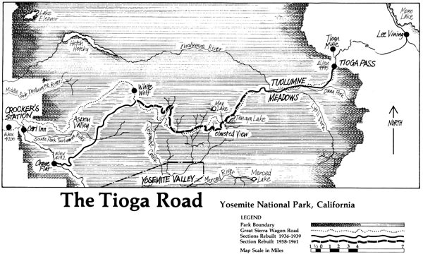
To find out more about the road's history, visit Keith Trexler's informative illustrated website: The Tioga Road: a History 1883-1961, from which the map below is reproduced:
Keith A. Trexler (1931-1975), The Tioga Road; a History 1883-1961 (Yosemite Natural History Association 1961, 1980). 28 pages. Illustrated. 23 cm. Saddle stitched in paper wrappers. Bibliography. No copyright. Originally published as “The Tioga Road,” Yosemite 40(3) (1961).
Digitized by Dan Anderson, June 2006 from a personal copy. These files may be used for any non-commercial purpose, provided this notice is left intact.—Dan Anderson, www.yosemite.ca.us
![]()
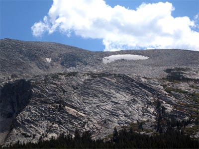
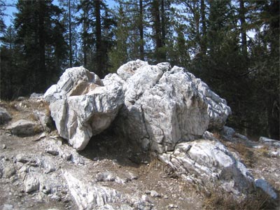
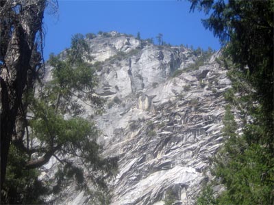
The dense forests at the lower elevations gave way to fields of barren granite ...
Hank stands lookout!
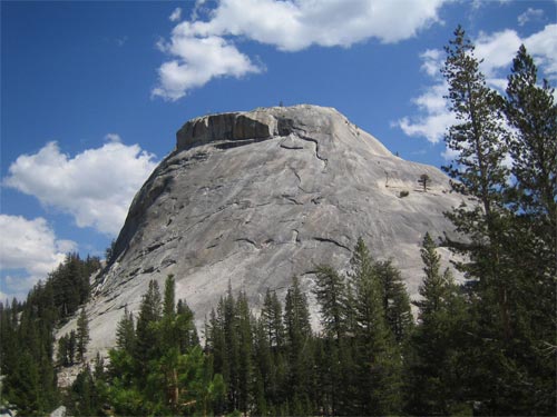
There are two climbers on Pywiack Dome (elev. 8851 ft). Can you find them?
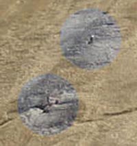
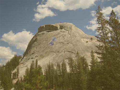
See them now???
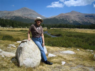
The Tioga Road had quite a variety of landscapes including placid meadowlands -- like Dana Meadow (above), tall mountains -- like Mt. Dana (elev. 13,053 ft) in the distance on the left...
and craggy rocks.
![]()
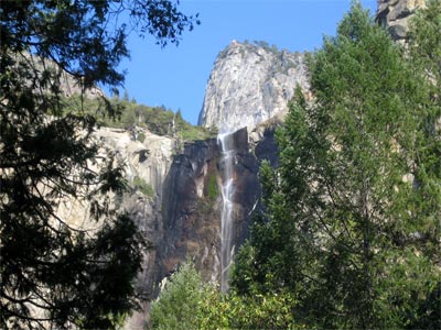 |
Back in the Valley, we stopped for a brief look at the wispy Bridalveil Falls. The water of Bridalveil Creek falls 620 feet! It was still flowing (though very weakly) despite the extremely dry conditions. So little water was able to make it down to the base that the view was actually better from a distance with the lower, drier half of the cliff obscured by trees. |
![]()
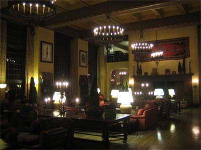
We ended the day with a scrumptious dinner at the grand Ahwahnee Hotel.
![]()
Monday, 10 September
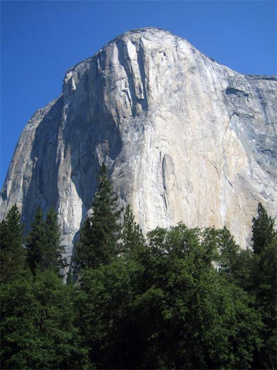
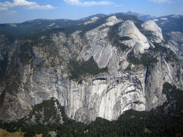
The next morning we headed off to Glacier Point, stopping first to admire the sunlit face of El Capitan as we left the Valley. It is the largest solid block of exposed granite in the world and stands over 3000 feet above the Valley floor, twice the height of the Rock of Gibraltar.
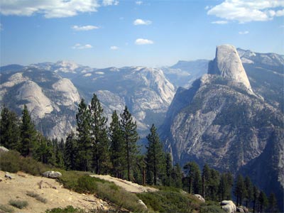
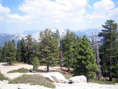
Along Glacier Point Road, we got to see a side view of Half Dome.
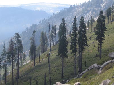
Trees line up on the lush mountain side.
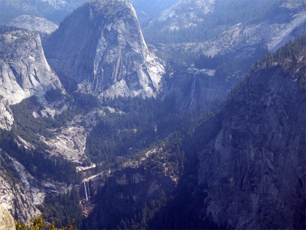
From Glacier Point, there is a great view of Vernal Falls (visible on the lower left of the picture) and Nevada Falls (just a little right of center). Vernal Falls drops 370 feet into the Merced River landing in a beautiful emerald green pool. Further upstream, Nevada Falls cascades down 594 feet. The prominent rounded rock feature situated between the two falls is Liberty Cap.
| Here is a closeup of Vernal Falls.... | 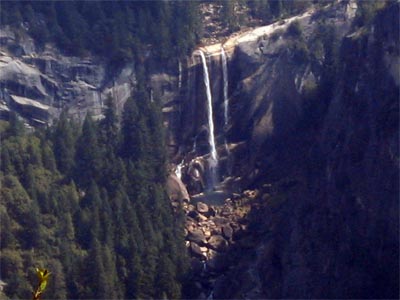 |
| Here's how the scene looked in 1956. Nevada Falls can be seen just to the right of the center tree. Vernal Falls is the vertical white streak visible on the tree's lower left side. Liberty Cap rises above the tree's top. | 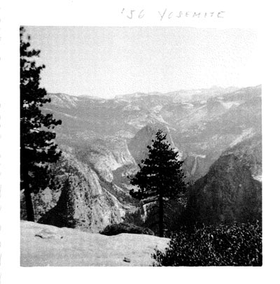 |
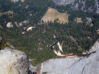
The views of the Valley from Glacier Point were really amazing. Ahwahnee Meadow is the broad open field in the center of the picture. The Ahwahnee Hotel is located in the upper right corner. The Merced River meanders through the landscape from Curry Village on the right, to Yosemite Village to the left of the meadow, and then on toward Yosemite Lodge off the left edge of the picture.
Sun and shadow bring the Royal Arches into relief. North Dome rises above the Arches and Basket Dome can be seen on the right.
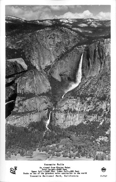
A jutting overhang at Glacier Point seems to point to the bone dry Yosemite Falls. Dropping a total of 2425 feet, Yosemite Falls is one of the world's tallest waterfalls (see the chart below). Even though no water was flowing, we could see the lingering imprint of its effects on the cliff's face.
| If we had come in the spring, we might have seen this instead: | Falls | Height | Tallest Drop |
Location | ||
 |
1 |
Angel | 3212 ft | 2648 ft | Venezuela | |
2 |
Tugela | 3110 | 1350 | South Africa | ||
3 |
Tres Hermanas | 3000 | Peru | |||
4 |
Olo'upena | 2953 | Hawaii, US | |||
5 |
Vinnufossen | 2822 | 1378 | Norway | ||
6 |
Baläifossen | 2788 | 1482 | Norway | ||
7 |
Pu'uka'oku | 2756 | Hawaii, US | |||
8 |
James Bruce | 2755 | BC, Canada | |||
9 |
Browne | 2744 | 800 | New Zealand | ||
10 |
Strupenfossen | 2690 | Norway | |||
11 |
Ramnefjellsfossen | 2685 | 1968 | Norway | ||
12 |
Waihilau | 2600 | 2600 | Hawaii, US | ||
13 |
Colonial Creek | 2584 | Washington, US | |||
14 |
Mongefossen | 2535 | 2535 | Norway | ||
15 |
Gocta | 2531 | Peru | |||
16 |
Mutarazi | 2499 | 1572 | Zimbabwe | ||
17 |
Kjelfossen | 2477 | 490 | Norway | ||
18 |
Johannesburg | 2465 | 800 | Washington, US | ||
19 |
Yosemite | 2425 | 1430 | California, US | ||
20 |
Trou de Fer | 2380 | 1000 | Réunion Island |
[information from World Waterfall Database]
Half Dome as seen from Glacier Point on 10 September 2007.... |
and as captured by the same photographer on the same date in 1956. |
 |
 |
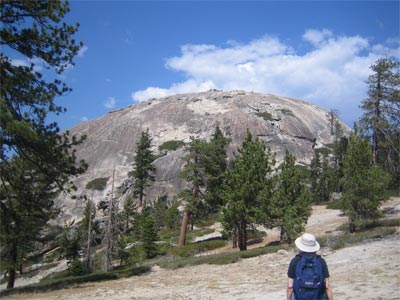
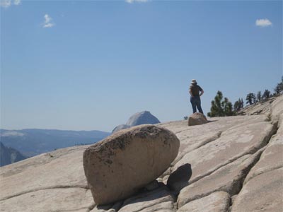
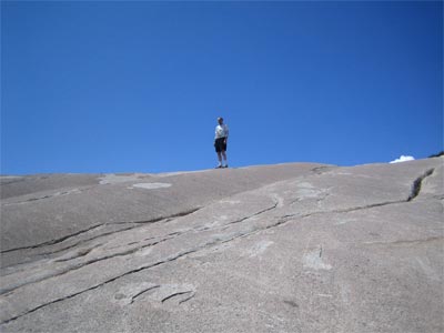
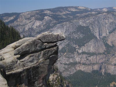
After we left Glacier Point, we drove a couple miles down Glacier Point Road to the Sentinel Dome and Taft Point trailhead. At an elevation of 8,122 feet, Sentinel Dome is nearly a thousand feet higher than Glacier Point.
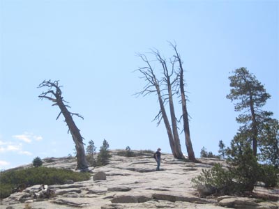
Part way up Sentinel Dome....
...we get a view of Half Dome. The Sierra Nevadas are barely visible against the cloudy horizon.
![]()
We hurried back to the trailhead to join a ranger-led hike to Taft Point.

Phaedra taught us a lot about the geology and botany of the area.
She showed us a quirky quartz pillow made up of quartz crystals and feldspar, two of granite's sturdiest ingredients.
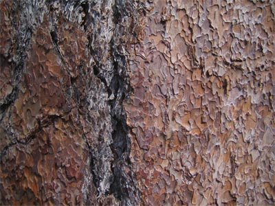
She got us to walk up and smell the bark of a Jeffrey pine.
Believe it or not, sniffing the Jeffrey pine made us feel like we were inside a bakery shop! Wonder if it tastes as good as it smells?
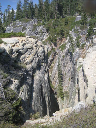
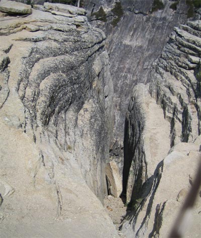
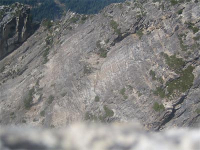
Phaedra showed us the geological features Taft Point is known for -- fissures.
Granite is almost indestructible, but if water can seep into a crack, it will eventually cause the crack to widen and split. For now these rocks are stuck between a hard place and another hard place!
Someday, the fissure that traps them will widen further and they will fall like the rock seen in the picture above.
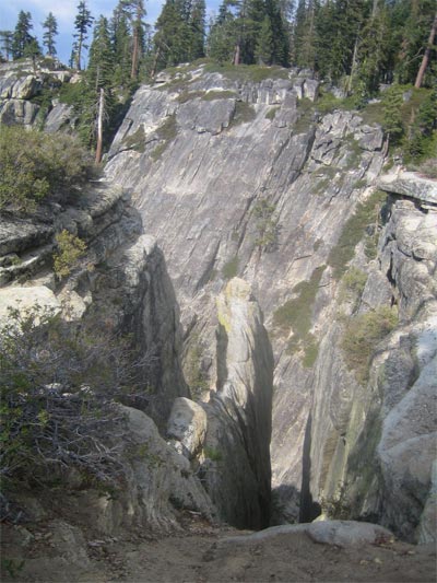
A wall of granite separates two deep fissures.
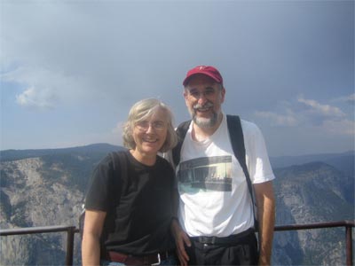
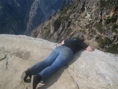
Here we are at Taft Point!
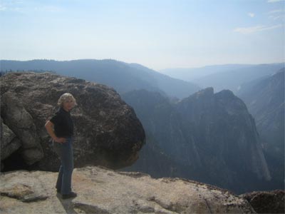
The cliffs are definitely not for the acrophobic.
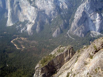
The view of the Yosemite Valley is breathtaking.
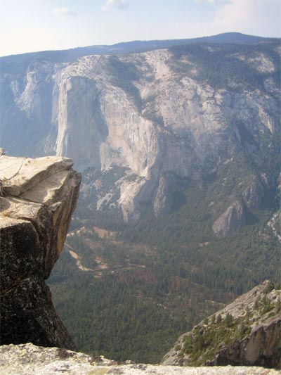
The Merced River winds across the Valley floor past the sheer cliff of El Capitan.
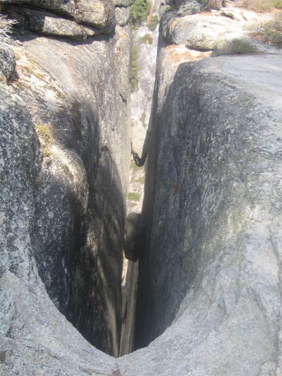
Phaedra showed us a safe way to peer over the edge.
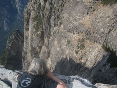
How deep is it?
A photograph cannot reproduce the dizzying sensation.
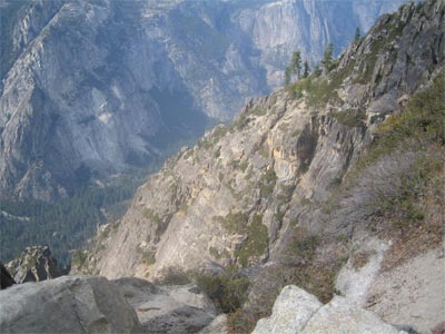
No matter where you look, it is a loooong way down.
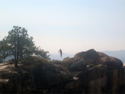
That didn't seem to bother this anacrophobic acrobat....
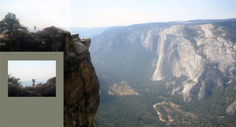
Splicing together a couple of photos gives some idea of the scale. The man on the wire was posing for professional photographers. How much would they have to pay you???
![]()
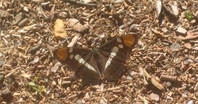
Back down on the Valley floor, we spied a lovely California Sister (Adelpha bredowii eulalia) butterfly....
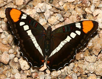
Here's a "real" photo of the California Sister gleaned from the web.
![]()
![]()
![]()
Tuesday, 11 September
I convinced Hank, against his better judgment, to accompany me on a hike to Vernal Falls.
The water of the Merced River near the Nature Center had a remarkable green cast.
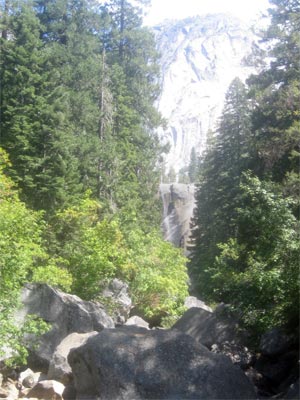
We made the uphill climb to the bridge crossing the Merced where we got a bare glimpse of the falls ahead.
Craggy cliffs walled in the river and the path.
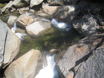
The green water tumbled easily down the rocks while we puffed and panted up them.
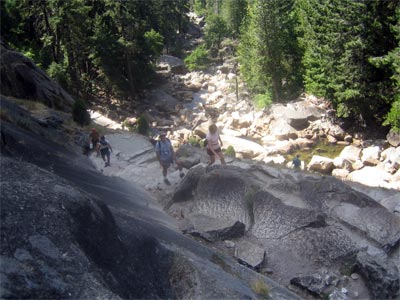
The not-so-misty Mist Trail includes a stone staircase which were hard to climb and harder to descend.
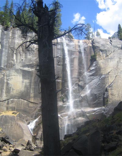
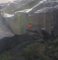
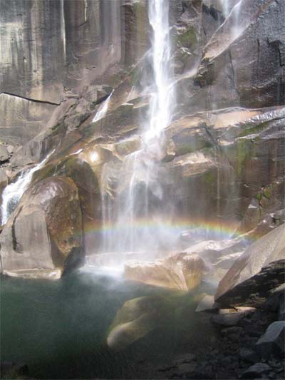
Finally a view of the falls! To get a sense of the scale, look for the dark orange dot in the lower right quadrant of the photo. It is the shirt of a man seated on a rock near the falls.
The roar of the water is terrific....
(click on the image above to see -- and hear -- the action!!!)
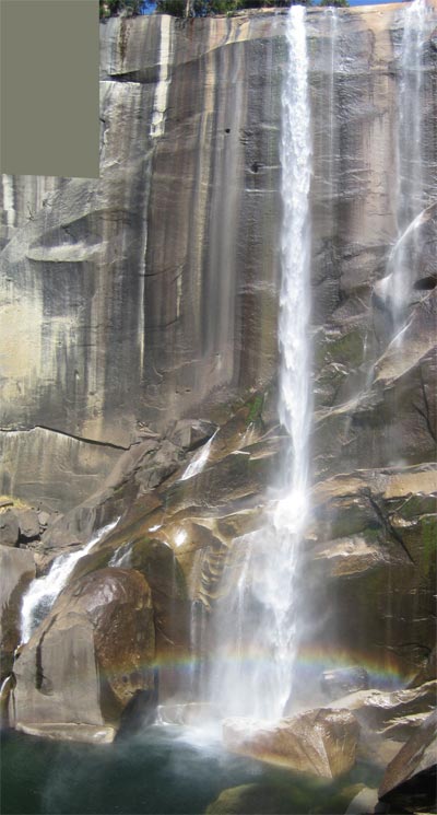
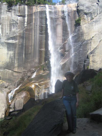
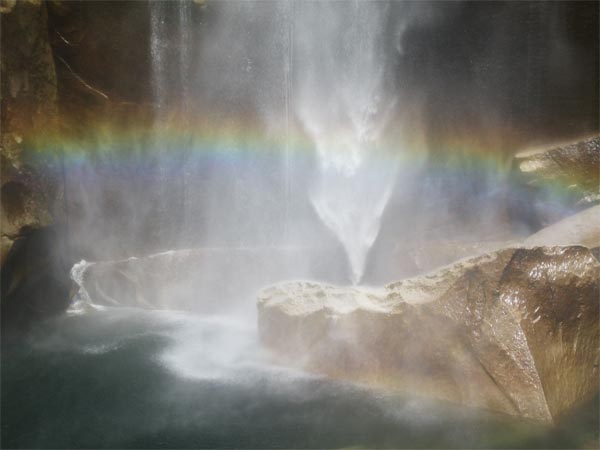
A couple of spliced photos gives a full view of the 370 ft falls (with rainbow!!) plunging into the chilly water below.
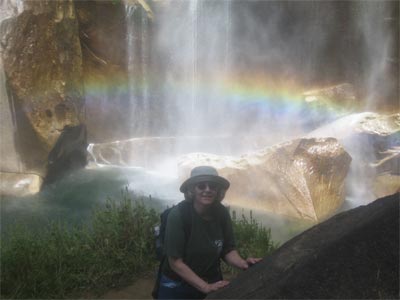
I wonder if there's a pot of gold nearby?
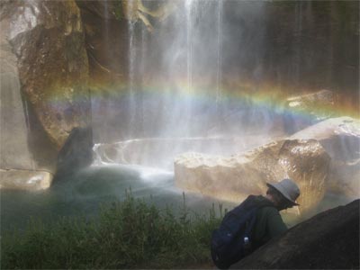
Let's see....
No gold. But we did find something better -- a wonderful spot to eat our peanut butter and jelly sandwiches!
![]()
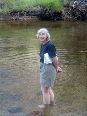
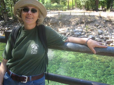
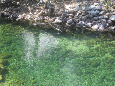
When we got back to the Lodge, our tired tootsies needed a soak in the cool water of the Merced.
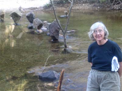
Since our first evening's visit to the spot, it seems that Andy Goldsworthy has been here!
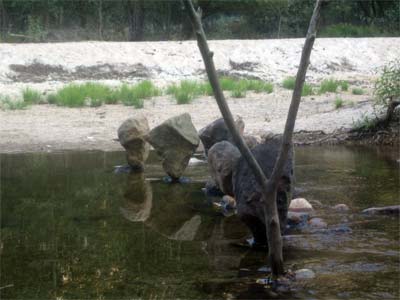
A row of precariously perched rocks march across the river....
while Half Dome reflects serenely from its surface.
![]()
![]()
![]()